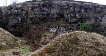
Pontygwaith Quarry
From South Wales Climbing Wiki
| Pontygwaith Quarry | |
 | |
| Rock Type | Quarried Sandstone |
|---|---|
| Climbing Style | Undeveloped |
| Approach Time | |
| Area | Sandstone |
| Sub Area | Sandstone Western Valleys |
| Geodata | |
| WGS-84 Location | 51.635361, -3.435046 |
| OS Grid Ref. | ST 00781 93925 |
| WGS-84 Parking Location | |
| GR Parking Location | |
| Base Elevation | 256 metres (SRTM Estimation) |
| General Info | |
| Faces Direction | |
| Aspect | |
| Wind Sheltered | |
| Climbing Type | |
| Seepage | |
| Crags Within 5.0 km | |
|
Blaenllechau, Brittania Quarry, Clydach Vale Bogmonster Quarry, Clydach Vale Cambrian Quarry, Dan Dicks, Edmonston Quarry and Edge, Ferndale Lower Quarry, Ferndale Main, Ferndale Right, Gelli, Glynfach, Llwynypia, Maerdy - Rhondda Fach, Mountain Ash, Mountain Ash Natural Buttress, Mountain Ash West, Penrhiwceiber Quarry, Pontygwaith Quarry, Porth, Punk Rocks, Sheriff Quarry - Maerdy, The Farm, Ton Pentre, Trebanog, Trehafod, Turberville Road Quarry, Tylorstown Quarry, Ynyshir Quarry, Ynyshir West | |
Contents
BOLTING POLICY
PREAMBLE
ACCESS
THE ROUTES
First Ascents
