Geology
Geology of South Wales for Climbers
Overview
The majority of the climbable rock in South Wales is found within and along the margins of the South Wales Coalfield. The Coalfield is an elongated basin, 90 km long by 30 km wide, stretching from Pontypool in the east to Kidewelly in the west and from Taff's Well in the south to Merthyr Tydfil in the north. This geological structure can be viewed simply as a buried avocado, with a limestone skin, Mudstone for its flesh and Sandstone as the seed, all tipped to a jaunty angle southwards. The bedding angle of the rocks have a dip of about 10° to the south along the northern edge, and about 50° to the north along the southern edge, these angles reduce towards the centre of the basin to near horizontal.
Geological History
The story of South Wales Geology is one of the rise and fall of the land, due to the movement and interaction of tectonic plates, leading to erosion and deposition respectively. The position of Wales has also shifted, drifting ever northwards from its once tropical position.
During the Devonian period (400 million years ago), the South Wales landmass was above sea level. However, it subsided during the following Carboniferous period (starting approx. 360 mya) permitting the sediments, which form the rocks, to be deposited. The two varieties of rocks that climbers are interested in are limestone and sandstone.
Initially, the limestone was deposited on the sea bed, which deepened towards the south. Subsequent tectonic compression, caused by the approach of a continent from the south, made the sea more shallow. Vast quantities of sediment, eroded from the landmass to the north, formed river and coastal deltas along the coastline. These sediments remain within the area now described as the 'Coalfield'.
At the end of the Carboniferous period (approx. 300 mya), the two continents collided, and Wales became a landmass again, part of the supercontinent Pangea. During the coming Permian and Triassic periods, erosion rather than deposition was the rule. In the early Jurassic period (approx. 200 mya) Pangea broke up and a shallow sea opened that led to limestones (the "Lias") being deposited south of the Coalfield (visible in the cliffs of Ogmore). With no further deposits of interest after this period all that was left was for the crags to be sculpted. Erosion during the intervening geological periods, glacial erosion and the industrial activities of man have led to the outcrops we see in the current landscape.
The Carboniferous Limestone
Limestone is essentially calcium carbonate, a salt, imagine it as a less soluble version of table or sea salt. Creatures extract it from sea water to make their shells, and hot tropical seas become supersaturated with the stuff, so much so, that it drops out and forms a lime mud.
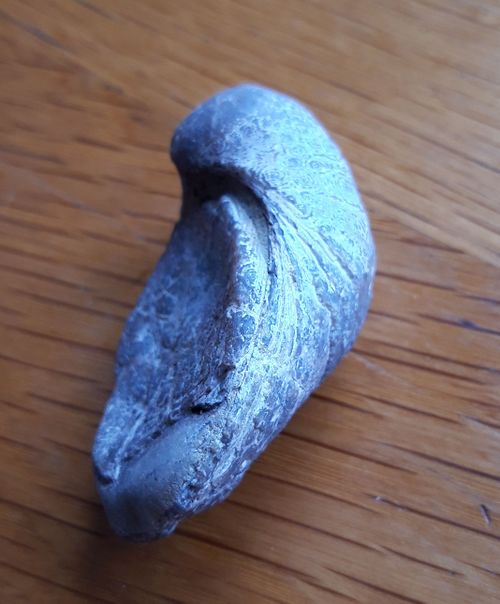
In the warm tropical Carboniferous seas of South Wales huge coral reefs developed, underwater crinoid gardens grew, brachiopods filtered the waters and nautiloids and bony fish swam in the clear waters. Shell debris, coral fragments and lime mud were mixed together. Over time, with burial and the application of temperature, pressure and mineralised waters, the whole mix became a rock. The long (mostly) horizontal breaks that are often seen in sedimentary rock outcrops are called bedding planes and these form weaknesses that weathering exploits and exaggerates. The bedding planes are often formed by a change in the environment of sediment deposition, such as a drop or rise in the ancient ocean floor or a shortfall in the supply of sediment. Where the ocean floor drops, thin deposits of dark mud are often present, which are easily eroded by frosts and plant roots.
Vertical fractures, or joints, are caused by increases and decreases in earth pressure, due to tectonic movements or burial and exhumation of the rocks. Joints generally become more open as overlying rocks are eroded, leading to pressure release and expansion. In the case of limestone, the bedding planes and joints are further exploited by water which dissolves it, often preferentially, along these pre-existing lines of weakness. This erosion leads to the formation of pipes, pockets, weird scalloped walls, tubes and caves. Mineralised waters also deposit the dissolved calcium carbonate to form tufas and crystals.
The Coal Measures (Sandstone)
The Coal Measures are so named because of the series of economic coal seams contained within them. But they are a lot more interesting than that. Separating them from the underlying (older) Carboniferous Limestone are the rocks formally known as the Millstone Grit (no introduction required). They are very hard and filled with quartz pebbles, unfortunately they are a denuded sequence, forming squat outcrops that only dedicated boulderers can exploit.
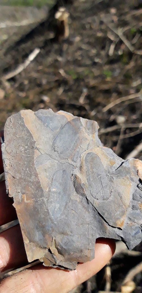
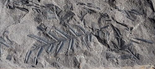
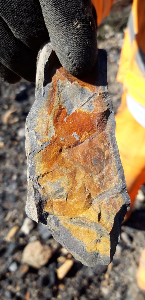
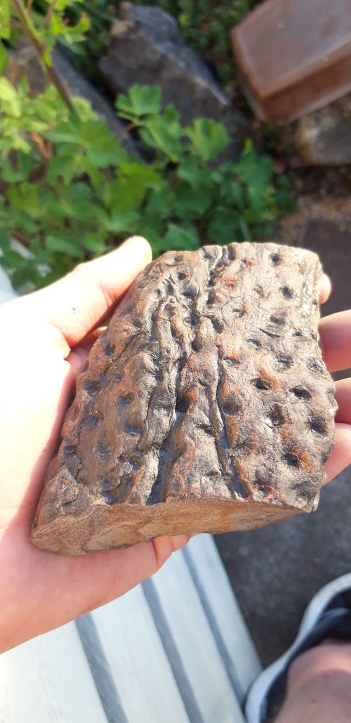
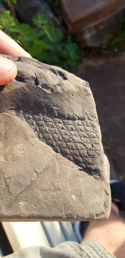
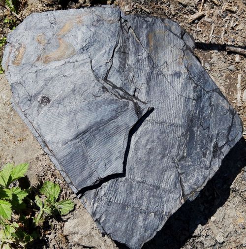
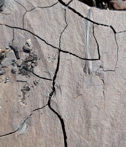
In early Carboniferous times flora played a major role in rock formation, forests stabilised coastal floodplains and vast swampy rainforests developed. Fossil fragments of the giant 30 metre clubmoss trees and horsetail trees are regularly encountered, imprinted on the undersides of sandstone blocks on the quarry floors. With all this plant life, the oxygen content of Earth rose, to approximately 35%, allowing arthropods to grow to huge sizes, such as the mythical giant dragonfly with a 60cm wingspan, and 2m long centipedes. The rainforests created huge thicknesses of peat which, when periodically buried due to relative sea level rises, formed the thick coal deposits we see today. Muds buried the rainforest, but gradually the sediments built up to form new land and braided rivers full of sand formed the platform for new forest growths.
In the later stages of the Carboniferous period, mountains rose and created a rain shadow over these swamps. Cooler, drier conditions saw the forests withdraw and the flora changed to a shrub and conifer type. The hitherto dominant amphibians were advesely affected, and reptiles developed, which were better suited to the conditions. The 'Pennant' sandstone deposits we see today formed from braided river deposits in the mid to late Carboniferous times; these rivers cross cut each other frequently, lagoons formed, and old deposits were ripped up and redeposited in these highly mobile environments. A fortunate side effect of this constant erosion and deposition are rolled mud pebbles or tree fragments, which weather out preferentially to form the classic pocket holds within thick sandstone beds.
Permian and Triassic Period
With the closing of the oceans, South Wales then formed part of continental Pangea, an arid, desert-like place. Over this period, erosion removed thousands of metres thickness of Carboniferous and older rocks. The Triassic deposits are variable ranging from breccias, the result of storm floods that washed down great quantities of sediments from the highlands, to muds laid down in quickly drying lakes where salt deposits (evaporites) formed. Unfortunately, only on Sully Island can anything be gleaned of these strata for the climber’s interest.
The Jurassic Blue Lias
Eventually the supercontinent Pangea broke apart, forming two new continents, Laurasia and Gondwana, with an ocean between them called the Tethys Sea. A detached sliver of the Gondwana continent, called Cimmeria, made its way northwards to collide with the southern side of Laurasia, the plates buckled and the ancient Tethys sea breached and flooded the area with a warm shallow sea. When the sea rose, elevated areas of older rocks formed an archipelago of islands, upon the flanks of which limestones were deposited.
The Sutton Stone occurs only on the coast of South East Wales and comprises a conglomerate of limestone with black chert pebbles formed at the very edges of the islands. This rock is a freestone, meaning it has no internal bedding and very few fractures. This makes traditional gear placement tricky at the start of the routes at Ogmore Popular End.
Directly overlying the Sutton Stone is the Blue Lias, conspicuous by its alternating bands of sandy limestone and Mudstone. These interbedded deposits have several possible mechanisms of formation, regular sea level changes, short-term climatic variations leading to changes in calcium carbonate precipitation, and post depositional calcium carbonate migration. Anyone climbing at Ogmore will find that unless you follow a well-defined crack-line, the protection potential of the routes varies in relation to the thickness of these Mudstone bands.
The Blue Lias contains numerous fossils, some very different from the Carboniferous fossils. Corals and Crinoids were still around, but the brachiopods had been usurped by the bi-valves, and the earliest ammonites had started to swim in the seas, food for marine reptiles such as the Ichthyosaur and Plesiosaur. A walk along the wave cut platforms of the Jurassic Coast will allow you to see many of these fossils, some in great detail.
Structure
The colliding continents which gave rise to Pangea at the close of the Carboniferous period introduced the Hercynian Orogeny (mountain building period) These compressional forces created the synclinal (trough like) structure of the Coal Field. To the north, limestone outcrops along the northern side of the A465 from Gilwern (Clydach Gorge) to Glyn-Neath (Dinas Rock) and continues westwards into the Black Mountains of Carmarthenshire. The crop then bends round to the coast near Llanelli. Its southern tract follows the coastline through Gower and beneath Swansea Bay, through Bridgend and then follows the northern side of the M4 north of Cardiff and Newport. The eastern edge is easily visible along the north-south trending escarpment west of Cwmbran, Pontypool, and back to the starting point in Gilwern.
The strata dip more steeply (northwards) along the southern edge of the Coalfield than the corresponding strata dip (southwards) along the northern edge of the crop. There are several other structural features along the margins of the Coalfield and also within it, the main ones being the Neath Valley Disturbance, a large northeast-southwest trending fault-line, between Llandarcy and Dinas Rock. Another obvious north-south trending fault-line cuts the limestone crop at Taffs Well, allowing passage of the Afon Taff through a wide gorge like cleft, overlooked by Castell Coch.
Within the centre of the Coalfield the Middle and Upper Coal Measures, dominated by the competent Pennant Sandstones, were less affected by the compressional earth movements and are generally near horizontally bedded. A secondary phase of tectonic movements occurred in more recent Mid Cretaceous times; associated with the building of the Alps, this also affected the Lias rocks. The effects of these earth movements can be seen particularly well in the cliffs either side of Dunraven Bay. Witches Point being a particularly good example of a reactivated Hercynian aged fault zone, in the underlying contorted Carboniferous Limestone, affecting the overlying stratified, and more plastic, Lias beds.
The Ice Age
The Ice Age, which included many phases of glacier advance and retreat, incised the cwms, or U-shaped valleys, we see today within the South Wales Valleys. On the current coastline, where glaciers failed to reach, the permafrost and dramatic rising and falling of sea level during this period left its mark on the coastal cliffs.
Beyond the Ice Age
There has been limited change to the scenery since the last glacial stage ended 10,000 years ago, the most evident though is the activity of man. Mining has resulted in the infilling of valley bottoms and impressive coal tips mantling the valley crests. Sandstone extracted locally for building stone and limestone, burned in lime kilns and used as road stone, has resulted in a huge number of bites out of the valley sides, providing the majority of locations for inland climbing.
The Future
What does the future hold? Will our coast become flooded with subsequent advanced cliff recession? Do predictions of increased rain intensity scupper the chances of visiting dry cliffs, or even trigger landslides making the valley sides dangerous unpredictable places? Will the economy dwindle, making extraction of local resources a necessity once again? No one really knows, so let’s be grateful for the opportunity we have right here right now and consider how our actions may impact future generations.
What to Look Out For
Inclined bedding is visible along the Right Hand Walls of Taffs Well Main and forms the large roof at Castle Quarry.
A large solution cavity infilled with large quartz crystals is present in the Third Wall at Castle Upon Alun quarry.
Spiky balls of calcite can be seen attached to the steep Back Wall at Taffs Well West. The Lower Cave Area at Dinas Rock has formed in the core of a spectacular symmetrical anticline, formed by the Neath Valley Disturbance.
Solution pipes are visible in the roof of the Lower Cave Area and through the route Groovy Tube Day at the Main Cliff
Scalloping due to water flow is visible on the right hand end of The Inflated Roundhead wall.
A short walk upstream from Dinas Main Crag is a silica mine used to extract the Millstone Grit for use in making refractory bricks.
Gilwern Main has a nice wall covered in small flowstone pipes. Gilwern East has a superb vertical solution pipe and a glued breccia of Limestone cavity rubble on the climb Asteroids.
At Dunraven Cliff tufa formation is well defined on the routes at Tufa Terrace. Faulting and folding is obvious at the left side of the Stone Wings cliff.
Unconformities abound at Ogmore, the Sutton Stone forming the start of the climbs in the Popular Area and the wave cut platform being much older Carboniferous Limestone. Above the beach, Triassic breccia can be seen infilling Carboniferous Limestone gullies.
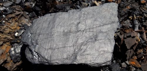
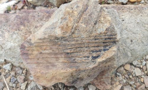
Natural sandstone outcrops show well defined cross bedding where long periods of weathering have picked out the individual ripple sets and cross cutting beds. Plant fossils are particularly evident in sandstone quarries where thin shale layers and coal partings are present. Look for diamond patterns or segmented horsetail stems.
