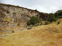
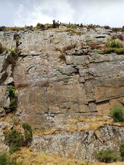
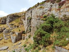
Turberville Road Quarry
From South Wales Climbing Wiki
| Turberville Road Quarry | |
 | |
| Rock Type | Quarried Sandstone |
|---|---|
| Climbing Style | Undeveloped |
| Approach Time | |
| Area | Sandstone |
| Sub Area | Sandstone Central Valleys |
| Geodata | |
| WGS-84 Location | 51.621459, -3.417624 |
| OS Grid Ref. | ST 019 923 |
| WGS-84 Parking Location | |
| GR Parking Location | |
| Parking Postcode | CF39 0NP |
| Base Elevation | 245 metres (SRTM Estimation) |
| General Info | |
| Faces Direction | |
| Aspect | |
| Wind Sheltered | |
| Climbing Type | |
| Seepage | |
| Crags Within 5.0 km | |
|
Blaenllechau, Brittania Quarry, Clydach Vale Bogmonster Quarry, Clydach Vale Cambrian Quarry, Dan Dicks, Edmonston Quarry and Edge, Ferndale Lower Quarry, Ferndale Main, Ferndale Right, Gelli, Glynfach, Llwynypia, Pontygwaith Quarry, Porth, Punk Rocks, The Farm, Ton Pentre, Trebanog, Trehafod, Turberville Road Quarry, Tylorstown Quarry, Ynyshir Quarry, Ynyshir West, Ynysybwl Lady Windsor Quarry, Ynysybwl Upper Quarry | |


