Hollow Top
| Hollow Top | |
 | |
| Rock Type | Natural Carboniferous Limestone |
|---|---|
| Climbing Style | Trad |
| Approach Time | 30 minutes |
| Area | Gower |
| Sub Area | Thurba to Overton |
| Local Area | Hollow Top to White Pillar |
| Geodata | |
| WGS-84 Location | 51.549568, -4.252035 |
| OS Grid Ref. | SS 439 858 |
| WGS-84 Parking Location | 51.561586, -4.242797 |
| GR Parking Location | SS 446 871 |
| Parking Postcode | SA3 1PE |
| Base Elevation | 12 metres (Other) |
| General Info | |
| Faces Direction | West |
| Aspect | Partially Sunny |
| Wind Sheltered | Seldomly |
| Climbing Type | Normal |
| Midge Problem | Never |
| Seepage | Quick drying |
| Crags Within 400m | |
|
Above Freelunchers Zawn, Below East Gully Groove, Blackhole Gut, Devil's Cwm, Eos Zawn, Fetlock Zawn, Hollow Top, Horses Cliff, Juniper Wall, Liberty Zawn, Paviland Far Far West, Paviland Far West, Paviland Main Cliff, Stalking Horse Zawn, White Pillar, Yellow Buttress | |
PREAMBLE
This crag appears to be named, "Yellow Top" on old Ordnance Survey maps.[1] Is this the origin of its current name? Talbot (1970) appears to be the first to use it. Was this the text obscured at a fold in Jeremy Talbot's map?
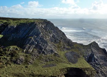
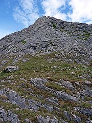
This slabby and somewhat scrappy lump of rock overlooks Juniper Wall and, according to J. Talbot, also overlooks "Groaning Hollow" [2]
Loose in places but not quite as loose as it looks.
ACCESS
Access from the free parking at Pilton Green, (SS 446 871 or 51.561586, -4.242797). On the right-hand side of the B4247, approx. 2 miles before Rhossili. Park on the grass at the edge of the track leading to a farm. Cross the road, bear left and take the public footpath (signposted to Foxhole Slade) through the 'kissing-gate' on the left of the sandy-coloured house (Clifflands). Reach the top of a dry valley after about 20 minutes and numerous gates. (1.34km). At the landward end of the valley is a wooden kissing-gate (SS 438860).
Go through the kissing gate, descend a short way (to the Wales Coast Path) and then turn left (east - signposted to Port Eynon) up the steep side of the valley and then head east for 160m on the path until you get to a broad vague valley leading down to the sea. Follow the valley downwards (for 200m) on a narrow path.
Hollow Top is the large, rounded collection of slabs on your left. Juniper Wall is on the other (western) side of the zawn (Eos Zawn).
TIDAL STATUS
Non-tidal.
DESCENTS
Walk down west or east.
THE ROUTE
1. Hollow Top 45m M
The route takes any line up the slabby south western face.
J.Talbot 00.00.1963
