Ynysybwl Upper Quarry
| Ynysybwl Upper Quarry | |
| ( Ynysybwl Quarry ) | |
 | |
| Rock Type | Quarried Sandstone |
|---|---|
| Climbing Style | Trad |
| Approach Time | 10 minutes |
| Area | Sandstone |
| Sub Area | Sandstone Central Valleys |
| Geodata | |
| WGS-84 Location | 51.640283, -3.3521548 |
| OS Grid Ref. | ST 06575 94375 |
| WGS-84 Parking Location | 51.640479, -3.3575603 |
| GR Parking Location | ST 065 943 |
| Parking Postcode | CF37 3LY |
| Base Elevation | 185 metres (SRTM Estimation) |
| General Info | |
| Faces Direction | South West |
| Aspect | Partially Sunny |
| Wind Sheltered | Seldomly |
| Climbing Type | Normal |
| Seepage | Needs a short dry spell |
| Crags Within 5.0 km | |
|
Abercynon High Buttress, Brittania Quarry, Dan Dicks, Glynfach, Golf Club Crag, Mount Pleasant, Mount Pleasant (X2), Mountain Ash, Mountain Ash Natural Buttress, Mountain Ash West, Navigation Quarry - Cilfynydd, Penrhiwceiber Quarry, Porth, Punk Rocks, The Darren, The Gap, Trehafod, Turberville Road Quarry, Ynysboeth, Ynyshir Quarry, Ynyshir West, Ynysybwl Lady Windsor Quarry, Ynysybwl Upper Quarry | |
PREAMBLE
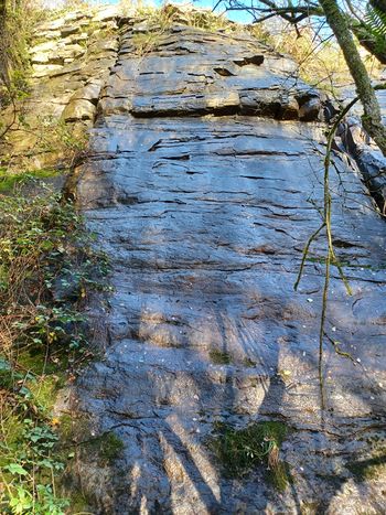
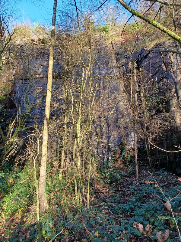
A relic from the past, this quarry has become overgrown with willow and bramble at its base and the surrounding land is nigh impenetrable bramble. A solid bushwhack is required to access. The rock is clean but does not pass the modern safety standards for sandstone in its current form. With a great deal of love this could be turned into a pleasant low grade sandstone sports crag but would still only be of interest to locals.
Old Description 2003, p. 479:A pleasant sheltered crag, with sound rock, although there is frequent seepage on routes off the main slab. Protection is sparse so dig out your gritstone head. The belay is frightening (a wobbly sapling in a collapsing shale bank) on the routes off the main slab.
ACCESS
From the centre of Pontypridd take the Ynysybwl turn off by the main Police Station (B4273). Continue into Ynysybwl. After the residential housing on the left hand side, take a right hand turn, over the river and uphill. Park at the second gate onto the reclaimed colliery site, without blocking it. Follow the path towards the Transmission tower on the hillside crest. After 100m trun right on the shonky road and follow it a short distance until it opens out. A vague track leads up the hill on the left, follow ths steeply until about 20m below the plateau top. Head left through brambles and gorse etc to reach the quarry (unpleasant).
See Map Of Gower and SE Wales (probably incorrect)
THE ROUTES
1. For Pete’s Sakes - E1,5a *
The left-hand line up the obvious central slab. Abseil from the tree. 12m
A.Sharp 02.02.1991 [1]
2. You Drip - E1,5a
The right-hand line on the slab. Abseil from the tree. 12m
A.Sharp, P.Lewis, J.Harwood 02.02.1991
3. Ass-Slider - E2,5c
The centre of the wall at right angles to the main slab, BR. 9m
P.Lewis, A.Sharp, J.Harwood 02.02.1991
4. Snowman - E3,5c
The short arête to the right on creaking flakes. 8m
P.Lewis, A.Sharp, J.Harwood 02.02.1991
Additional Photos
Notes
- ↑ "We all soloed this. I have a note that it was VS, 5a!" - email to T.Hoddy from John Harwood 15/08/21
